NewsRescue
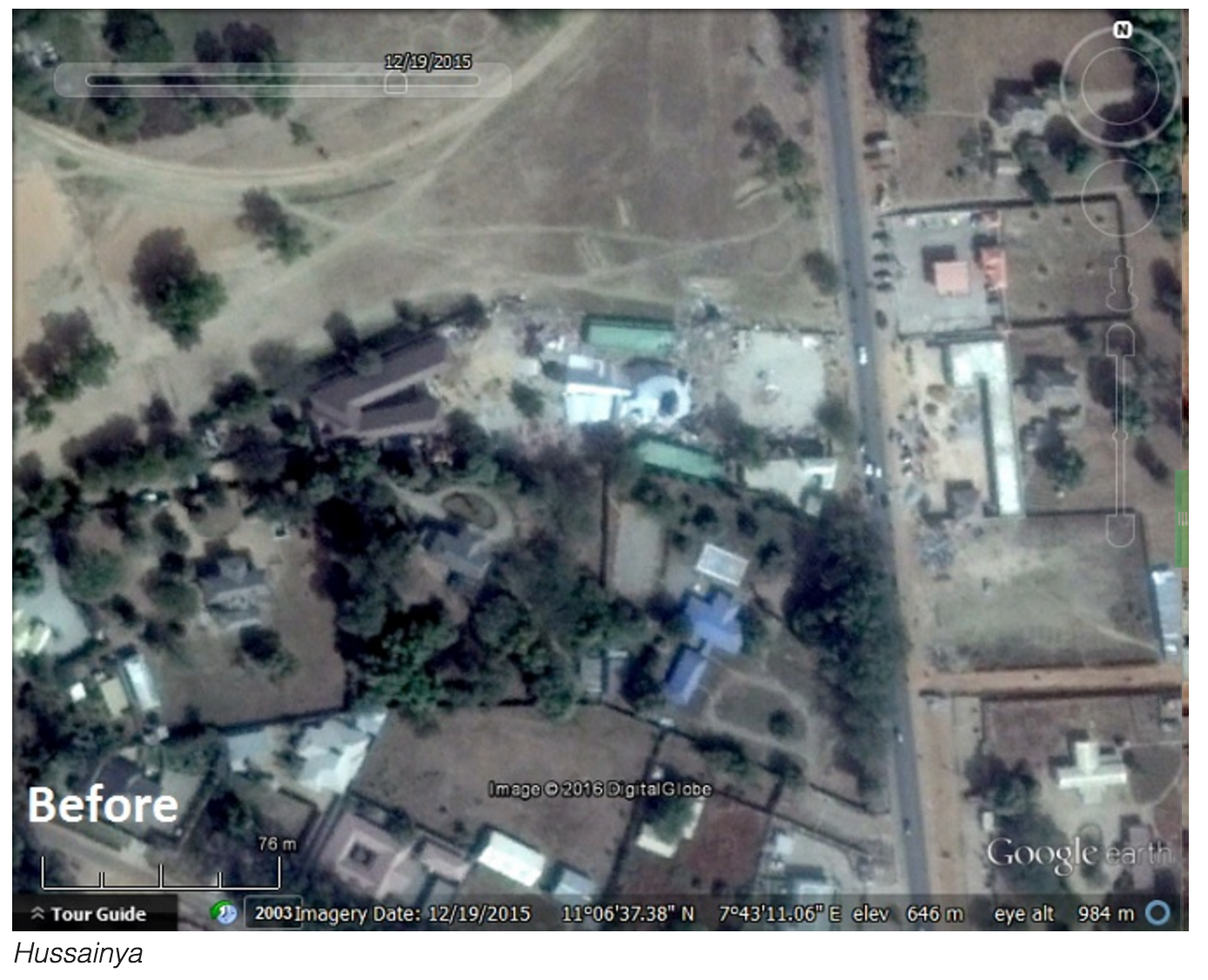
Timothy Whitehead of the Google Earth Blog has demonstrated that power of satellite imagery in forensic crime scene investigations, bringing out 6 accurate interactive Google earth images capturing the before and after of the demolition of the six locations in Zaria by the Kaduna state government and Army during the Zaria massacre that left as many as 100 dead and 347 victims admittedly secretly buried in a single mass grave by the Nigerian government.

The follow-up demolitions against Shia Islam happened at Hussainiyyah center, Darul Rahma burial ground, Islamic Movement film site, Zakzaky’s mother’s house/shrine, Gyellesu Zakzaky compound and Fudiyyah Islamic center as can be seen in before and after stills of the images from Google earth blog below. Some places were so badly burnt and demolished, even trees were not spared:


