NewsRescue
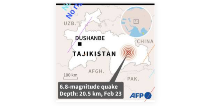
A 6.8-magnitude earthquake struck the mountainous east of ex-Soviet Tajikistan on Thursday, killing no one and causing no damage, according to officials.
The quake struck at a depth of about 20.5 kilometers (12.7 miles) at 5:37 a.m. local time (0037 GMT), according to the US Geological Survey.
The USGS estimated that the quake would expose “little or no population” to landslides, and the Tajik emergency committee later stated that no victims or damage had been reported.
The epicentre of the earthquake appeared to be in Gorno-Badakhshan, a semi-autonomous eastern region bordering Afghanistan and China, approximately 67 kilometers from the small mountain town of Murghob.
About 20 minutes after the initial quake, a 5.0-magnitude aftershock struck the area, followed by a 4.6-magnitude quake.
The sparsely populated area is surrounded by the towering Pamir Mountains, some of which reach 7,000 meters (22,965 feet) above sea level, and is home to Lake Sarez.
The aquamarine-colored body of water, formed by an earthquake in 1911, is one of Tajikistan’s largest lakes.
A natural dam deep in the Pamir Mountains lies behind Lake Sarez, and experts have warned of catastrophic consequences if the dam is breached.
Tajikistan, with a population of 9.5 million people, is the poorest former Soviet republic, and, like much of Central Asia, is prone to natural disasters, with a long history of floods, earthquakes, landslides, avalanches, and heavy snowfalls.
Earlier this month, nine people were killed in an avalanche in Gorno-Badakhshan, and another was killed the same day in an avalanche on a highway near Dushanbe.


